Lidar

Preventive archaeology

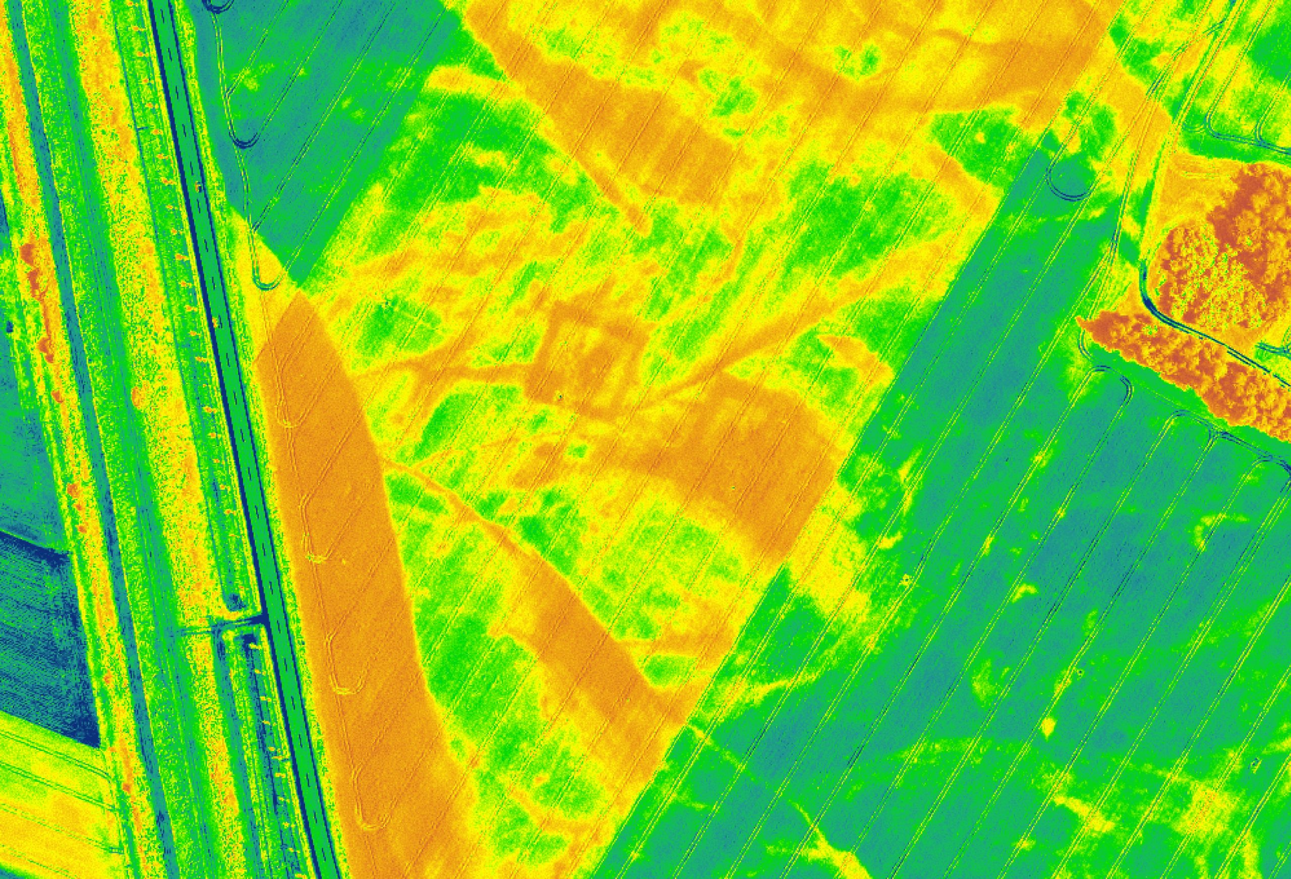
Preventive archaeology is the concept of protecting archaeological heritage in space. The aim is to document and protect as much as possible the archaeological heritage as an object, site and part of space through non-invasive and weakly invasive excavations.

Tasks of the Centre for Preventive Archology

It carries out various types of preliminary archaeological investigations to assess the archaeological potential of a site. Within registered archaeological sites, it carries out investigations to determine the content and composition of the site, which may take the form of intensive field surveys, drilling and hand-grid excavation, and the excavation of machine test trenches with documentation.


In addition to field work, it carries out geophysical surveys, aerial photography, laser scanning, etc.

Base

The Centre for Preventive Archaeology maintains and improves a database of ceramics and pottery found throughout the country. To date, several thousand pottery fragments have been collected and identified. Most of them are fine table and transport wares from the Roman period, as well as lamps. The pottery fragments are accompanied by information from archaeological research, the shape and type of the pottery, and information on its origin. The data from the database allow for comparison of ceramics between sites.

Aerial photography
Fieldwork
Geophysical surveys
Lidar

Aerial photography is carried out by taking dedicated oblique photographs from small aircraft. Most archaeological sites become visible through colour signs (in the soil) or vegetation signs (different growth and ripening of crops) and under specific conditions (drought, floods, low light, certain stages of plant growth). The extensive archive of Cyclical Aerial Photography (CAS) of the territory of Slovenia serves both to identify new archaeological sites, to monitor their condition, and to monitor changes in the whole area.

Within registered archaeological sites, the Centre for Preventive Archaeology carries out investigations to determine the content and composition of the site, which may take the form of intensive field surveys, drilling and hand-network excavation, and the excavation of machine test trenches with documentation. Preliminary archaeological excavation as a method is only used in cases of imminent physical threat to an archaeological site, when the site cannot be protected in space. It also carries out parallel underwater research in the form of extensive and intensive underwater surveys, underwater test probes and underwater archaeological excavation.

Remote sensing methods include geophysical surveys. Unlike other remote sensing methods, measurements are taken directly at the ground surface, not from the air. By measuring certain physical properties of the subsurface record, archaeological remains can be detected without physically disturbing them. The most commonly used geophysical methods, which are largely complementary in their message and are therefore often used together, are: the resistivity method, the magnetic method and the GPR method. The advantage of these methods is that they are non-invasive, as they do not interfere with the archaeological remains.

Laser surface scanning, often referred to as lidar, is a remote sensing method that can measure the Earth's surface with high precision. Lidar is a very suitable method for use in Slovenia due to its ability to observe the ground under forest cover. In order to be able to observe archaeological traces with lidar, they must be visible on the surface as bumps and protrusions, traces such as embankments, walls, dykes, or trenches, pits and ditches. Lidar has been used to discover a multitude of new archaeological sites, such as mounds, hillforts, castles, as well as new types of sites and traces of the past such as limestones, cairns, medieval fields and the like.

SNG Drama, Ljubljana (2023/2024)
The Prison Wall and the ancient cultural landscape between Sv. Ahac and Stražica
Preliminary archaeological excavations

SNG Drama, Ljubljana (2023/2024)

of 1410 m² were located within the walls - intra muros - of the Roman Colonia Iulie Emone, in its north-western part. The proximity of the Forum, the central public space of the colony, and the main Cardo, the city's main north-south street, carries great archaeological potential. The major part of the research took place in Insula XXXVIII, along Erjavčeva and Slovenská cesta (Sector 3). Along Igriška Street, we investigated a strip of the Roman road of chord A and insula XXXVII (Sector 2) and the Roman road of decumanus J, with the associated cloaca and insula XVIII (Sector 1). The results of the excavations exceeded expectations, as the archaeological remains were very well preserved from a depth of 0.70 to 3.30 metres. The oldest layers date back to before the foundation of Emona, when the area was used by Roman soldiers.

Aerial view of the excavations in October 2023. The excavations took place along Slovenska cesta, Erjavčeva cesta and Igriška street (photo: Tilen Kozamernik)
View of the excavation field, working shot (photo: Tilen Kozamernik).
Examples of good practice

The Prison Wall and the ancient cultural landscape between Sv. Ahac and Stražica

When verifying the references and reports on the boundary wall running along the western slopes of the Snežnica plateau between the sites of St. Ahac and Stražica near Ilirska Bistrica, we also identified, through the analysis of airborne laser scanning images, the remains of an old, probably prehistoric, land division and cultural landscape, judging by the shape analogies, which is located in the vicinity of the Trnovo hillfort overlooking Ilirska Bistrica.

News

Relevant information for owners gathered in one place.

Koper, Gravisi Tiepolo Palace, after renovation
7. 6. 2023

ZVKDS: Renovation of the GRAVISI TIEPOLO Palace in Koper

READ
14. 8. 2023

ZVKDS: UJMA 2023 - Begunje

READ
8. 3. 2023

ZVKDS: Heritage layers

READ

Search ZVKDS